A couple of weeks ago me and Kermit hiked a portion of the Foothills Trail to Laurel Fork Falls, and a bit past there and back again. It was a beautiful out-and-back hike from the Foothills Trail trail-head at the gravel parking area off the narrow dirt Horse Pasture Road, which is in the middle of a large conservation area known as Jocassee Gorges. This area abuts the southern Appalachian Mountains and is part of the geological feature known as the,"Blue Ridge Escarpment." It is a mountainous region that separates the Blue Ridge Mountains from the Piedmont. Check out these two interesting links
here and
here on Jocassee.
 |
| Kermit really enjoys getting out in the woods. |
 |
| Water break along the trail. Many of the small headwater streams that feed Laurel Fork Creek were dry |

Vast portions in the canopy of the forests of the southern Appalachians are dead. The eastern hemlock, Tsuga canadensis, is being decimated by the invasive pest known as the Hemlock Woolly Adelgid (HWA) (Adelges tsugae). The mite attacks the phloem of the hemlock, going after the nutrient-rich sap, which ultimately kills the tree. When I worked at the Cary Institute of Ecosystem Studies in Millbrook NY, I was able to see some of the damage the HWA can wreck on trees, but I never saw anything as widespread as the forests in Jocassee Gorges. Dr. Gary Lovett, a Forest Ecologist at the Cary Institute, is a fantastic scientist and does some really great, and important, research on the HWA, as well as other invasive plant pests. I did not see a single healthy (and only a few) living adult trees. The scattered small trees were few and far between, and they were all in very poor condition. I was, and still am, shocked by the havoc that the HWA has done to the southern Appalachian forests. I have read some of the peer-reviewed research on it, so I was aware of it from the intellectual side, but seeing the damage first-hand was eye-opening. I first saw it last November when I was in Jocasse for work, but spending two days and a night in the forest was a different experience.


 |
| Laurel Fork Falls, which feeds into Lake Jocassee |
I arrived at the trail head close to 2pm, I left my house several hours later than I anticipated, when life got in the way of my plans. So I hauled down the trail to the falls, which me and Kermit checked out from the overlook, before cutting back and exploring a way until we found a secluded spot to camp.
 |
| Kermit was pooped after a solid afternoon of hiking |
 |
| I used my homemade alcohol stove to cook up some pad-thai, a recipe my twin brother showed me. |
We camped near Laurel Fork Creek, it's a beautiful area. I had just enough daylight left after hiking the 9 miles at a breakneck pace to make camp and scrounge up wood for a nice relaxing fire.
 |
| pad thai! |
 |
| Sometimes I wonder if Kermit is confused as to why we spent hours walking in the woods to then sleep in the woods, and walk up and do it again the next day. Like any dog, he loves running around in the woods, but he also appreciates the finer things in life, like leather couches and warm houses. |
Kermit is a beautiful dog with a great temperament
 |
| Me and Kermit on one of the footbridges over Laurel Fork Creek |
The valley the Foothills Trail cuts down into is stunning, with mountain laurel and rhododendron dominating the understory of the forest. Sometimes I felt like I was walking through a green tunnel.
 |
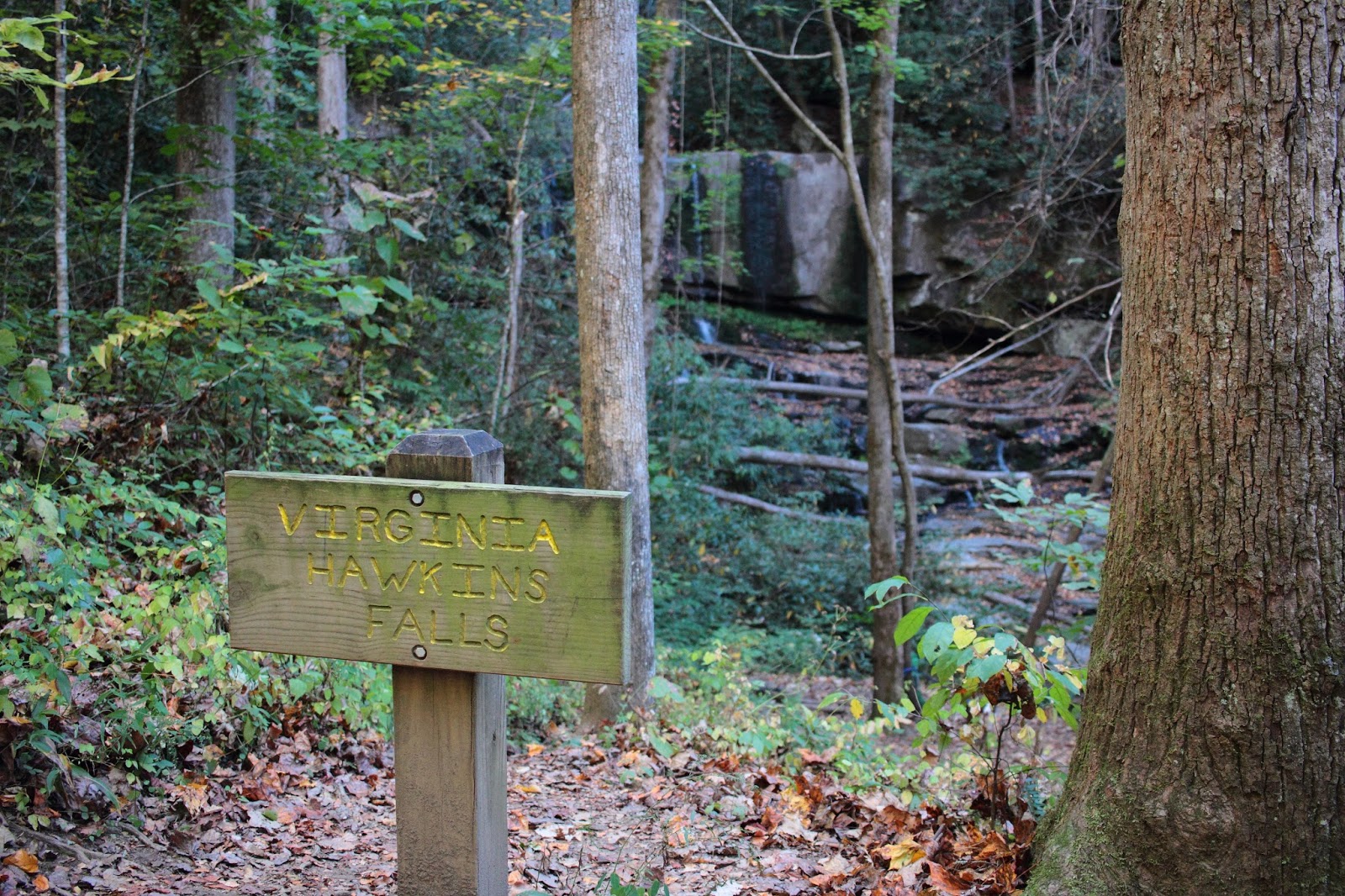
| A portion of the stairs along the Foothills Trail down to Virginia Hawkins Falls |
 |
| The trail passes by Virginia Hawkins Falls, which right now is only a trickle. When I saw it last year during a work trip, it had much more flow, and was quite impressive. |